Know before you go — BeachScan shows water clarity, tides, shade and live conditions for 21,000+ beaches.
Free to use · 7-day free trial on Premium · cancel anytime
Our algorithm analyzes wind, waves, water quality, UV, and temperature to generate personalized recommendations for each beach in real time.
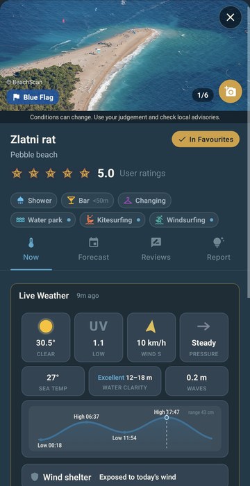
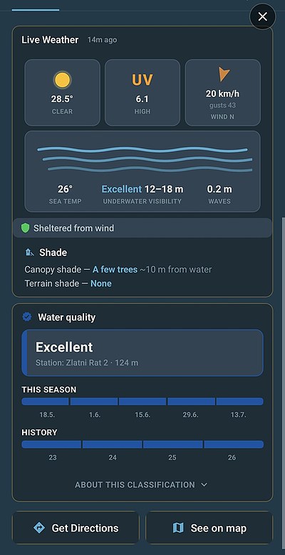
Live temperature, wind speed and direction, cloud cover, and precipitation from multiple verified sources, continuously updated — plus official weather warnings from the national services when one is in force for your area.
Almost 20,000 sea beaches get a live tide curve: where the sea sits right now, today's high and low water times, and how far it moves — with tide times on every forecast day.
Official bathing water classifications wherever the authorities publish them — live across Croatia and Greece, partial elsewhere while we work through each country's data. You always see which monitoring station the reading came from and how far it is.
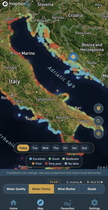
Estimated underwater visibility for each beach in metres. The model reads satellite ocean colour, then adds the things satellites miss: local chop stirring up the shallows, yesterday's murk still hanging around after a southerly, and the clearing that follows a hard offshore wind. Swimmers' reports keep it honest.
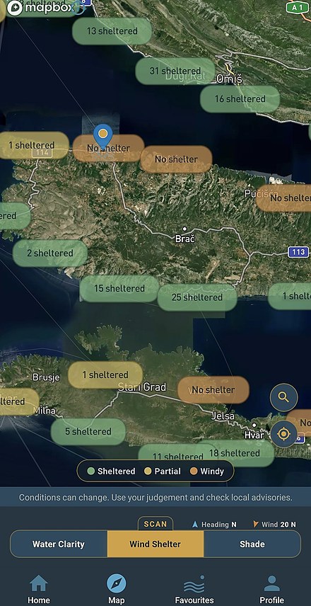
Looking for the best beach when it's windy? We trace how far the wind runs over open water to reach each beach, following the real coastline — now for all 19,509 beaches in all nine countries. It tells you which cove stays calm today, not just how windy the region is.
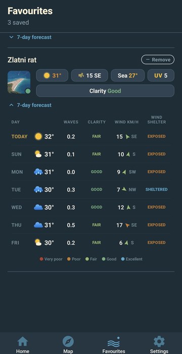
Plan ahead with daily beach forecasts. See which day will have the best conditions for your trip.
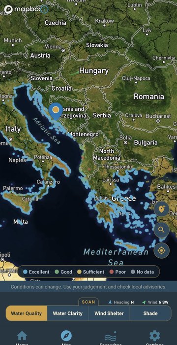
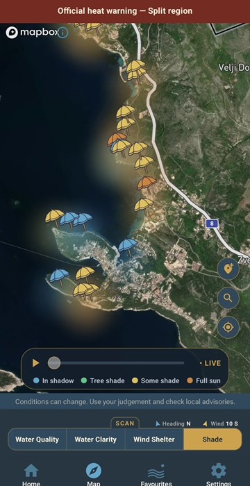
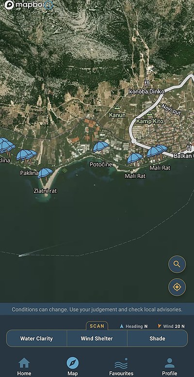
Explore beaches on satellite imagery and repaint the whole coast by water quality, water clarity, wind shelter or shade — every beach coloured by the answer, with clarity now carrying a chip for each day ahead.
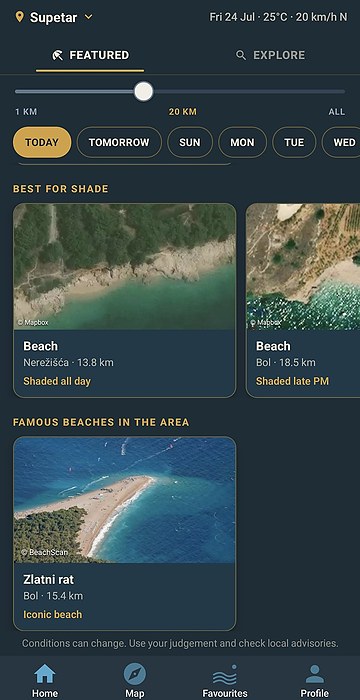
See when shade reaches each beach — from the terrain or from the trees behind it — hour by hour, computed from elevation models and measured tree canopy heights. Shows how much of the beach is shaded and how far the nearest tree shade is from the water.
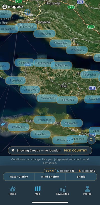
The map isn't a list of pins — it's an instrument panel. Switch the scan and the same stretch of coast repaints to answer a different question.
Every beach on the coast, coloured by the official bathing-water rating — Italy round to Albania, Greece and the islands.
Live weather, sea temperature, underwater visibility with a viewing range in meters, the tide, shade — and the official water quality classification from the nearest monitoring station, where the authorities publish one.
Zoom in and the clusters resolve into umbrellas — over 21,000 beaches mapped, from town beaches to coves you'd row past without knowing they had a name.
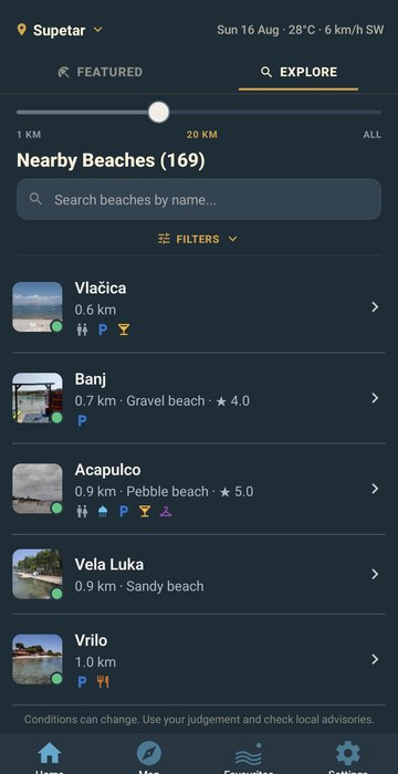
Set how far you're willing to go and browse everything inside that range. Filter by surface and amenities; sort by shelter when it blows.
Save the beaches you actually go to and compare them at a glance — air, wind, sea temperature, UV and clarity in one row each, with a 7-day forecast per beach.
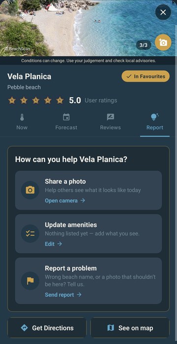
BeachScan starts from public data, and public data doesn't know that the shower block is new, that the sign spells the name differently, or that there's a cove down the goat path nobody has ever put on a map. You know, because you're standing there.
Every screen has a report button. Send in a photo, a fix or a whole missing beach, a person checks it, and from then on it's there for everyone who opens that beach — not just for you. That's the deal: a few seconds from you, better data for the next person.
Drop a pin where it actually is, name it, add a photo. Once it's approved it becomes a live beach for everyone — usually within about twenty minutes — with full conditions computed for that exact spot.
Show the beach as it looks today, not as it looked in a brochure. Approved photos appear on the beach card for every user, credited to you.
Wrong name, pin in the wrong place, wrong surface, a shower or car park we never knew about, a photo that isn't of this beach. Two taps, and the correction reaches everyone.
Long-press and tell us how clear the sea actually looks. Our clarity model gets checked against people in the water, not only against satellites.
Scenery, cleanliness, facilities, how it works with kids. Ratings are averaged across everyone who's been, so the next person gets a straight answer instead of one opinion.
Nothing skips review. A person reads every suggestion, photo and correction before it goes live — until then it's visible only to you. It's slower than publishing everything instantly, and it's the reason the data is worth trusting.
Drag the sun through the day and watch shade sweep across the coast — hour by hour, for every beach, cliff coves and pine-backed beaches alike.
Live today in Croatia, Slovenia, Italy, Greece, Spain (including the Canaries), Albania, Malta and Cyprus — plus Florida in the US. The app speaks English, Croatian, German, Italian, Spanish, French and Greek. More coasts coming.